
I first did this trip over 20 years ago with a group of fellow teachers during April vacation. While it was chilly, to say the least, and the weather wasn’t always kind, I fell in love with the remote wilderness experience that this river provides.
It’s remoteness and low traffic (especially in early spring) truly allows paddlers to disconnect from the hustle and bustle of society and enjoy the pace of the natural world.
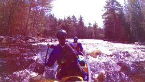
The Machias sometimes meanders and sometimes thunders southwest from a series of lakes about an hour and a half northeast of Bangor. Its balance of serene flat water interspersed with several class III rapids makes for a fantastic expedition.
I’ve approached this river in a variety of different ways. When I was younger and more restless, I paddled from Fifth Machias Lake to Machias (35 miles) in three days. A few years ago Julie and I found ourselves with an entire week so we did it in six days. (Much more enjoyable!)
Most of the time, due to the time demands of the real world, I paddle from the Rt 9 Bridge (Airline Rapid) to Machias in four days.
Rapids on the Machias
| Rapid | Class | Notes |
| Otter Rips | II | Shallow in low water. Difficult to scout, read and run |
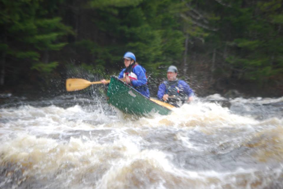
| Mile Long | II-III | This long rapid can present challenges. It’s difficult to scout because of its length, so it’s read and run. The river is narrow and rock-strewn which presents pinning hazards. (I’ve seen 2 pinned boats here that needed to be z-dragged). |
| Carick Pitch | III | The rocks here can pose some interesting line challenges. |
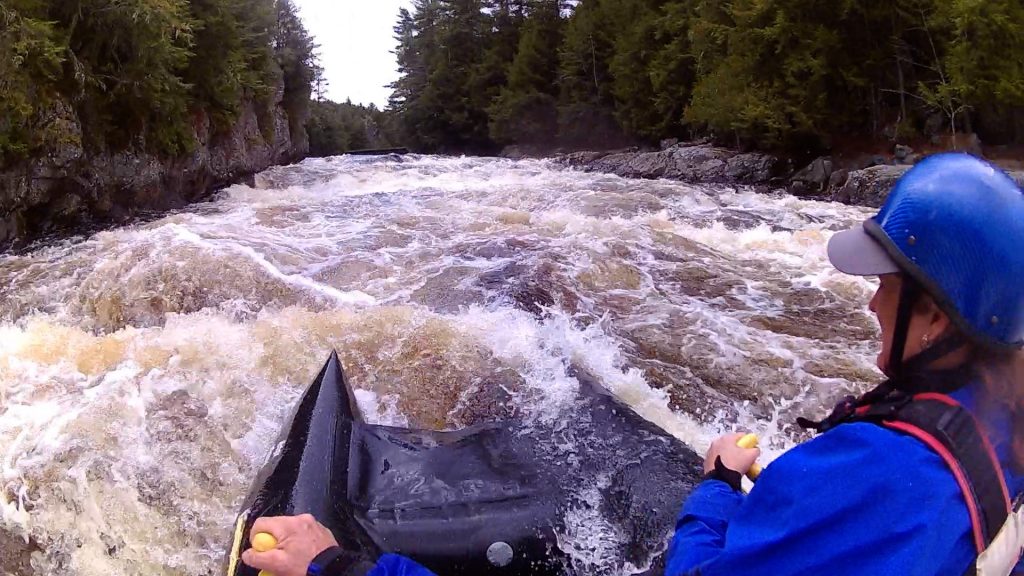
| Airline | III | Wave trains under the bridge can fill you with water which makes managing the S-turn downstream more of a challenge. It’s often rocky. |
| Little Falls | III | The approach to the most significant drop has many large standing waves. You can sneak down the left side. I always hit the biggest wave on the right hand “third” of the river. |
| Wigwam | III | Comes in 3 sections. The first section has large standing waves at high water. I run just right of center. After an S turn comes the second section (class II). After a pool of flatwater the river narrows and goes over a river wide ledge drop. The chute on the right tends to be the most friendly. |
| Upper Holmes | V | I highly recommend portaging this one! I’ve run it in a shredder (small inflatable whitewater raft) I have not run it in a canoe. |
| Lower Holmes | III | The beginning splits around an island. There is an easier run on the left of the island, but it’s narrow. Check before running because there can often be strainers hung up there. There’s another island after that that creates two channels. The right channel is narrow and rock-strewn. The left channel has a gnarly hole at the bottom on the right. It’s not retentive, but its angular nature makes it difficult to run upright. You can sneak down the left shore. |
| Great Falls | III | Long fairly straight forward rapid. The large waves make it challenging to run dry. About â…” of the way down it is possible to get to the right-hand shore and bail. I usually run just right of center. |
| Whitneyville | II or III | At the old dam in Whitneyville the rapid goes around an Island. The left-hand side has a 4-foot ledge drop. Depending on water levels you can scrape over the left-hand side or brave the wave / hole on the right. The right channel is class II |
When I first started doing this trip, I was young and…crazy. We paddled 10-12 miles a day. We went from Fifth Machias lake to Little Falls on day 1, then from Little Falls to Great Falls on day 2, then to Machias on Day 3. Those are long days!
For a more moderate version, I’ve put in at Airline (where Route 9 crosses the Machias), usually late in the afternoon, and paddled down to Little Falls. Then Little Falls to Wigwam, Wigwam to Great Falls, (long day), then Great Falls to Machias.
My favorite year trip we took a LEISURELY approach! I have to confess…there are some SHORT paddling days on this trip…which meant oodles of time hanging around camp by the river. We ran rapids a couple of times, surfed, enjoyed the sun”¦. A true paddling vacation!
Trip Itinerary
Drive, set up camp at Log Landing. You can access information on the Machias River Corridor here.
5th Machias Lake to Log Landing
Paddle Fifth Machias through Otter Rips, Mile Long, the two lakes, Karick Pitch, and back to camp. It was a bright sunny day and also my birthday. We spotted a hole that looked surfable just upstream from camp on the West Branch just before going under a bridge. We decided to get the shredder and a couple of beers and surf the hole. It was super sticky but not violent, so we decided to stash the paddles and hang out in the hole until the river kicked us out or we ran out of beer, Twenty-five minutes later, after hoots, hollers, and waves from fisherman driving over the bridge we ran out of beer. So we paddled back to camp.
Log Landing to Little Falls.
I like to run the wave train on the left going under the bridge, then work just right of center for the drop just downstream of the bridge. Then I work myself back left, make the S turn to the right, and do my best to avoid rocks.
Little Falls is an outstanding campsite. After the rapid, the river bends sharply to the right creating a sandy jutty with a beach and a high spot of land perfect for setting up tents. Who needs a white noise machine with the roar of the rapid soothing you to sleep? This site also boasts a fire pit and a rustic, dilapidated but functional outhouse. (Bring your own TP!)
Little Falls to Wigwam
The 3.3 mile paddle after Little Falls usually takes 70 minutes. The headwaters of Wigwam Rapid begin just after a cabin on the right. A dirt road that provides access to the camp can also be used to portage boats or gear. On year as we readied to carry gear some guys showed up on 4-wheelers and offered to shuttle gear down for us. We didn’t even pretend to protest although we did give them some venison steaks from our cooler as recompense!
The rapid begins as the river constricts and waves form. It is possible for all varieties of sneaking left or right trying to avoid the big waves in the middle. That’s why I run rapids with full floatation. Hey, Diddle-Diddle, right down the middle for me. Actually, just left of the middle. The big stuff comes in the first third of the rapid, then it’s just water-in-the-boat management until you get to the other cabin on the right. There’s a big eddy river right where you can pull the boat to shore and dump it out.
Just after this, the river bends right, then left, then constricts again into a Class II section that can approach class III waves in high water. I find it more challenging in low water trying to navigate rocks. There are a couple of small ledge drops that you sometimes have to scrape over. I’ve found river right has the best chutes.
After another short “pool” section you approach the 3rd section of the Wigwams: A four-foot ledge drop. Again, the chute on the left provides the most friendly line.
There’s a campsite river left just at the entrance of the rapid that ranks as my favorite on the river. It looks rarely used. (I stacked a few pieces of leftover firewood that remained in place for a full year, once.)

Despite its north-facing orientation, the ledge on the upstream side of the site provides an optimal river contemplation setting. Sitting by the fire perched just above the river just seems like the place to be. Back in the woods, a nice pine grove offers a pine needle cushion perfect for tent setting and resting tired paddling muscles. Once again, I enjoy listening to the sound of the ledge drop as I, myself, drop off to sleep.
Wigwam to Lower Holmes
From the Wigwam Ledges, it’s a relatively short 1-hour paddle to Upper Holmes Falls. Use caution while approaching the bridge! I would classify Upper Holmes as at least a Class IV if not V. The waves and holes are munchy, and I really don’t like the look of the gorge wall on the river right side. It could easily hide some undercut or crevice that may have captured some part of a tree.
There’s a tiny landing spot river left just above the bridge. We take out there and portage gear and canoes up the road/hill to the portage trail. The trail is in good shape and is probably a little less than 200 yards.
Since we bring the shredder, we always run Upper Holmes in that, but stick fairly close to the left-hand shore. Surfing the last wave is usually a requirement unless it’s pouring rain.
About a half-mile downstream comes Lower Holmes, which presents some challenges. Portage trails run on both sides of the river. The river left trail can often be overgrown with thick evergreens, but it appears to have thinned out over the years. I haven’t been over to the one on the right in several years, but it used to be fairly open.
The island at the top of the rapid houses a memorial stone of Obidiah Hill, a logger killed on the river. This island also separates the entry to the rapid. The right side offers a 3-4 foot ledge drop that is fairly smooth but will most likely splash some water in your boat. The left side is narrow and has fewer waves; however, some years I have seen strainers blocking the entire channel so be sure to scout before running.
Shortly thereafter a second island splits the river into two channels. Most of the water flows left. I usually take this line because it contains fewer rocks. From the right-hand side of the river, I work left as soon as I pass the first island and try to get just off the left bank. I run the drop that leads into the last section as slowly as possible to avoid crashing into a ledge, then turn the bow right and run the last ledge. I have attempted to run the leading drop in the middle over a large diagonal hole. I swam.
A large eddy Immediately follows the rapid. If we feel like a short day, we make camp at the ledge river left just after the rapid. The flat ledge extends down to the river edge which is a great place to hang out in the sun. Cords of beaver wood wash up along the shore. The woods don’t offer acres of level tent spots, but you can squeeze a small tent in there. While it is possible to set up on the ledge, I have seen water rise quickly there. Last year the water came up a foot overnight and covered most of the ledge.
Lower Holmes to Great Falls
Leaving Lower Holmes presents you with the longest stretch of flatwater on the river. It winds its way toward Smith Landing. And takes its time. I face a headwind 95% of the time. At Smith landing the river turns right past a couple of cabins, widens, and hurls headwinds at you for another 20-30 minutes until you reach another cabin marking the immediacy of Great Falls Rapid.
Great Falls is relatively long, With some big waves at high water! WOOHOO!!! The portage trail is on the right. I have seen it somewhat overgrown and covered with fallen trees, which can make it a challenge. It was clear this year, however, and leads to another great camping spot.

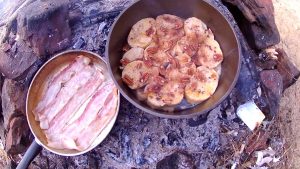
This spot can be an island with high water as some of the river spills into a six-foot wide depression in the ground. The river finishes the rapid with a sharp turn to the right, wrapping around the site. Some rock ledges on the upstream side of the site provide some picturesque, though distant, view of the rapid. Also, the eddy created by the bend and the beaver colony upstream provide a decent supply of firewood. (In the spring, anyway, before other boaters come through!) Several grilling grates adorn the rock fire pit.
Like Wigwam rapid, I prefer running just right of center. It is possible to work far left and avoid some of the bigger waves. At certain water levels, a crunch hole stands about a third of the way down. Water funnels water off the ledge on the right into the hole. On cold, rainy or certain water level days that I don’t want to hit it, I make sure to drive the bow right to avoid the hole. In most other circumstances, I inflate the bags and run it all!
Great Falls to Machias Take-Out
After leaving Great Falls, you quickly enter the alder meadow that was once filled with water from the old Whitneyville dam. Most times you are either blessed with a ripping tailwind or cursed with a headwind! The river is wide with not much current.
As you pass the remnants of some old log booms you will begin to see the steeple of the church in Whitneyville. The river bends to the left and splits around an island. The right side, containing significantly less water, forms a relatively easy Class II rapid. Mostly you simply have to avoid the rocks.
The left side of the island begins with a Class III series of waves (depending on water level) and culminates in a four-foot ledge drop. At high water, I have elected to scrape over the ledge on the left-hand side.
At slightly lower water, I run the “crashing-wave-kind-of-a-hole” feature near the river right shore. It looks pretty burly at high water, though I have never had any issues running it at medium levels.
The rapid is tough to scout because there’s no real trail running down the left side. You need to pick your way through the thick alders and brush and navigate the remnants of the old dam. On a sunny day, though, there’s a nice vantage point up on the rocks for lunch overlooking the drop!
There’s a small parking area near the bridge. One year we needed to shorten this day to make a First-Aid recertification class, so we used this as our take out.
After Whitneyville there’s about an hour to an hour and a half of paddling to get to Machias. There are a couple of short Class II drops, then wide flat water. Just before Machias, the river narrows and steepens, and can present some good class II-III waves depending on water level.
The take-out has a nice paved parking lot right on the water, river left, in Machias. Be sure to make the takeout! The river drops under the bridge and over Machias Falls which doesn’t look that fun in an open boat!
I hope you decide to check out this river! It’s truly a gem. If you have any questions, feel free to post them in the comments!
Happy Paddling!